Supply Chain Infrastructure in the Inca Empire
How Logistics, Luggage and Labor made Empire in the Highways of the High Andes
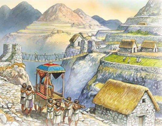
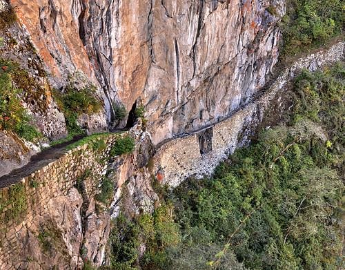
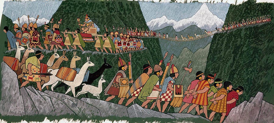
When Spanish Conquistadores first encountered the Inca Empire in 1528, it covered 690,000 square miles with a population estimated as high as 12 million - 2.7% of the world population at the time, equal to the contemporary Ottoman empire. By far it was the largest of the four pre-Colombian Meso-American empires and covered the most mountainous terrain on Earth, from modern-day Quito, Ecuador to Santiago, Chile, 3200 miles away. Connecting this sprawling domain was 25,000 miles of roads, just over half the number of miles of the entire US interstate system, but these were not just ordinary mountain paths: the road network consisted of carefully planned, engineered, built, marked and maintained paved highways replete with advanced engineering solutions like extensive switchback stairways, retaining walls, water drainage, and suspension bridges. Much of the road is in excellent condition 500 years later and in use to this day.
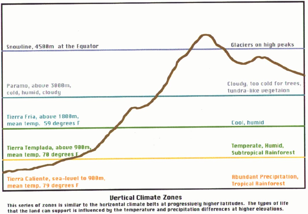
This road network served as the circulatory and nervous system of a massive empire with incredibly complicated social structure of religious, familial and community identities and tax obligations, and an ornate religious ceremonial system which interlinked political authority structure with a grand metaphysics of life, death, and rebirth of ancestor spirits within the Andean mountains, where life-giving water was squeezed from winds blowing over the Pacific by katabatic winds and a mountain range 13,000 feet tall. The complexities of managing Empire are a test of the scalability of social institutions and, peak-for-peak, the Inca empire was about a fifth the size of the Roman Empire under Augustus in terms of population and land area.
What makes this all the more impressive is that the Inca’s didn’t have wheels or a system of writing - the vast majority of freight was hauled by foot, and accounting systems maintained by knots in pieces of string called khipu.
The Inca Empire’s infrastructure was as extensive as it was multifunctional - imperial sites were areas of religious, economic, political and cultural significance; likewise roads facilitated the movement of all types of traffic and tampu’s - roadside supply depots provisioned by regionally taxed local populaces - served all varieties of purposes. This intermingling of the extensive highway and road networks for both economic, political and cultural functions illustrates how economic infrastructure is both the circulatory as well as nervous system of the body politic, exchanging vital resources as well as information to maintain cultural and political cohesion across a vast territory. The superior construction, immense magnitude and imposing grandeur of Inca roads, bridges and tampus led early European explorers to remark that it was better built, better maintained and better supplied than any road network in Europe
The general outline here is a discussion of infrastructure as it relates to economic processes with an exposition of staple and wealth finance economics, before turning to the role cities and palaces served in the economy of empire. Finally, a look at how infrastructure enabled both the political unity and cultural cohesion of the Inca empire writ large - known to its inhabitants as Tawantinsuyu - “The Four Regions Together”.
General Overview
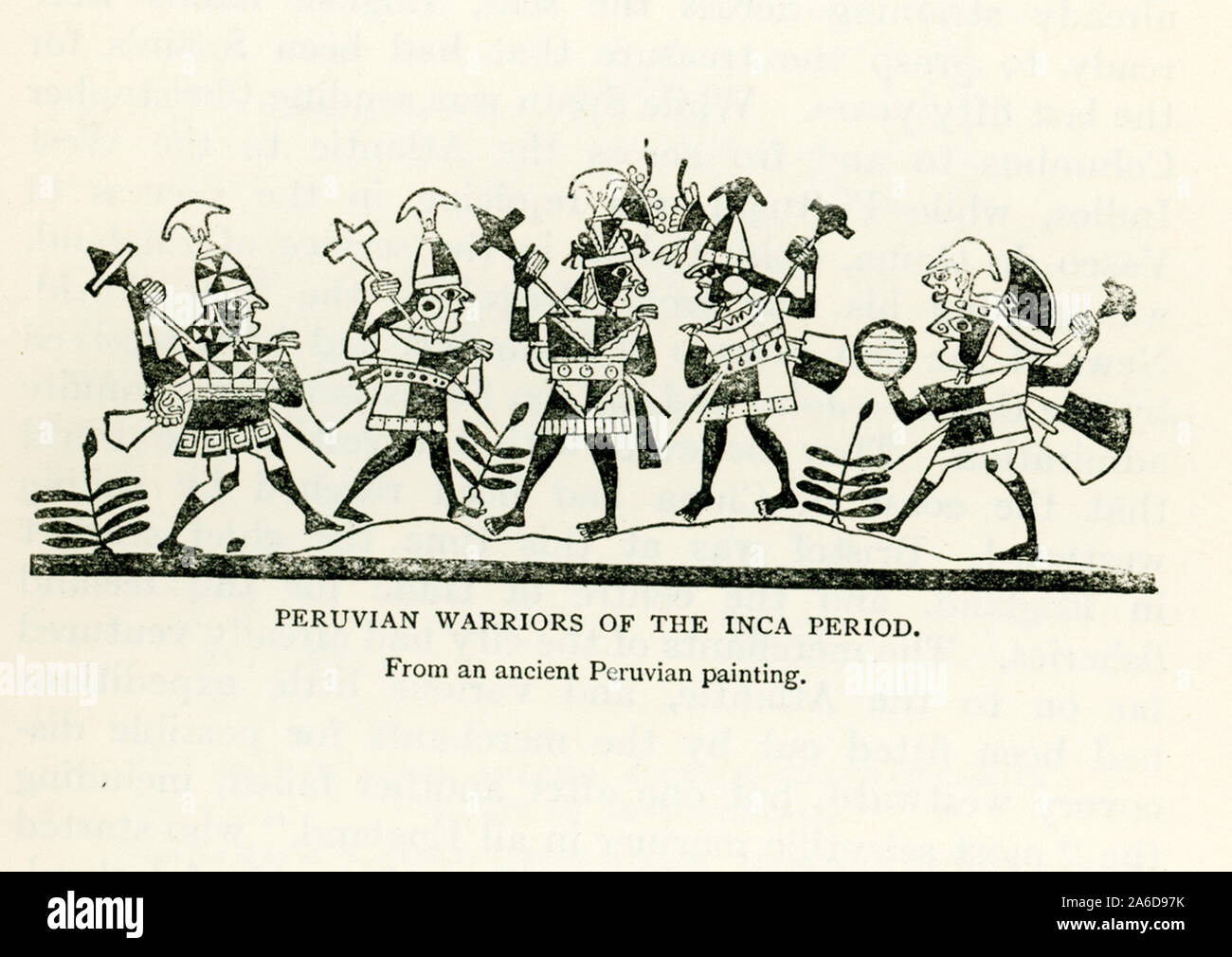
Administration of the Inca Empire can, broadly speaking, be described as a mixture of territorial control and hegemonic control (Covey, 1974, p. 184); Hegemonic political authority was tied to a religious structure that placed divine importance on Cuzco as the final executive authority, however territorial taxes and tribute were collected throughout the empire from semi-autonomous regions under local administration and governance. Territorial control was maintained by intensive restructuring of local economies and political structures as the Inca spread in influence between 1200-1500 CE, creating systems of labor taxation and regular tribute obligations to build, maintain, and supply a highway network which enabled the faster transport of military units to quell rebellion or advance the frontier of empire.
D’Altroy (1992, p. 95) outlines how the placement of storage and administration sites reflects regional variations in administration style: large facilities, such as temples, plazas, and extensive storage structures, were primarily located within major valleys central to what Covey (1992) refers to as the “Inca Heartland”; an area stretching from Quito to Cusco which saw the most intensely administered economic activities (p. 172). In provinces whose affairs were managed by local authorities, Inca built smaller structures for the collection of labor tribute and as a means of maintaining state presence and authority over local leaders (D’Altroy, p.97).
Despite variations in regional administrative approaches, the network of Inca roads, storage facilities and administrative sites followed consistent organization principles focused on efficient communication and transportation. The layout of this network suggests state planners were primarily concerned with minimizing the costs of movement between regional sites of authority, as opposed to maximizing the efficiency of transportation within regions (D’Altroy, 1992, p. 97). Thus, placement of Inca state centers at times bypassed local populations in favor of minimizing the distance between major sites (D’Altroy, p. 98). Such a layout is logical from a military perspective as it provides quick routes to potentially rebellious provinces; this layout also provides greater control over the storage and distribution of economic produce which was instrumental in maintaining authority over provincial populations (D’Altroy and Earle, 1985, p.192).
Highways of Empire
The road network that integrated Tawantinsuyu has been estimated by John Hyslop at covering 30,000km in total length (1984, p. 224), about 7 times the length of all interstate highway in the state of California, or just over half the number of interstate miles in all the US. Beginning his research in 1977, Hyslop’s work “The Inca Road Project” documents the extent and structure of Incan roads. These roads, he hypothesized, served ideological, military, ceremonial, economic and political functions depending on the regional location, however most were multi-functional. Hyslop explains that the four roads leading from Cuzco corresponded to the four principle divisions of the empire (340) and were an ever present sign of the state’s authority in far flung provinces (341). Indeed, without roads the continued management and integration of Tawantinsuyu would have been impossible (Hyslop, p. 247). The labor mi’ta, mitmaq and resettlement programs relied on and developed these roads (Hyslop, p. 248), however planning and engineering were overseen by Inca authorities (Hyslop 251-2). Considerable obstacles, such as marches, solid rock mountainsides, rivers and steep traverses were overcome using a variety of methods of sufficient engineering quality to continue to be used to this day (Hyslop, Chap 15).
Overall planning of this road network emphasized straightness between major centers and only made accommodations for environmental features, not local populations (Hyslop 251-2). This supports the argument of D’Altroy (1992) which states Inca’s were primarily concerned with interregional integration rather than regional economic efficiency. Two main north-south highways, one along the coast and one along the sierra highlands, provided access to the predominantly longitudinal Inca Empire (Hyslop, p. 257). These two major routes were interconnected at important junctions and also fed into branch routes that led to frontier provinces and westward into the mountains (D’Altroy, 1992, p. 97; Hyslop, p. 258), supposedly to provide military access to outposts or ceremonial usage of mountaintop shrines (Hyslop, p. 268). If one were travelling along Inca roads in many locations it would be impossible to miss the frequent storehouse compounds, tampu.
Tampu, Chaskiwi and Bridges
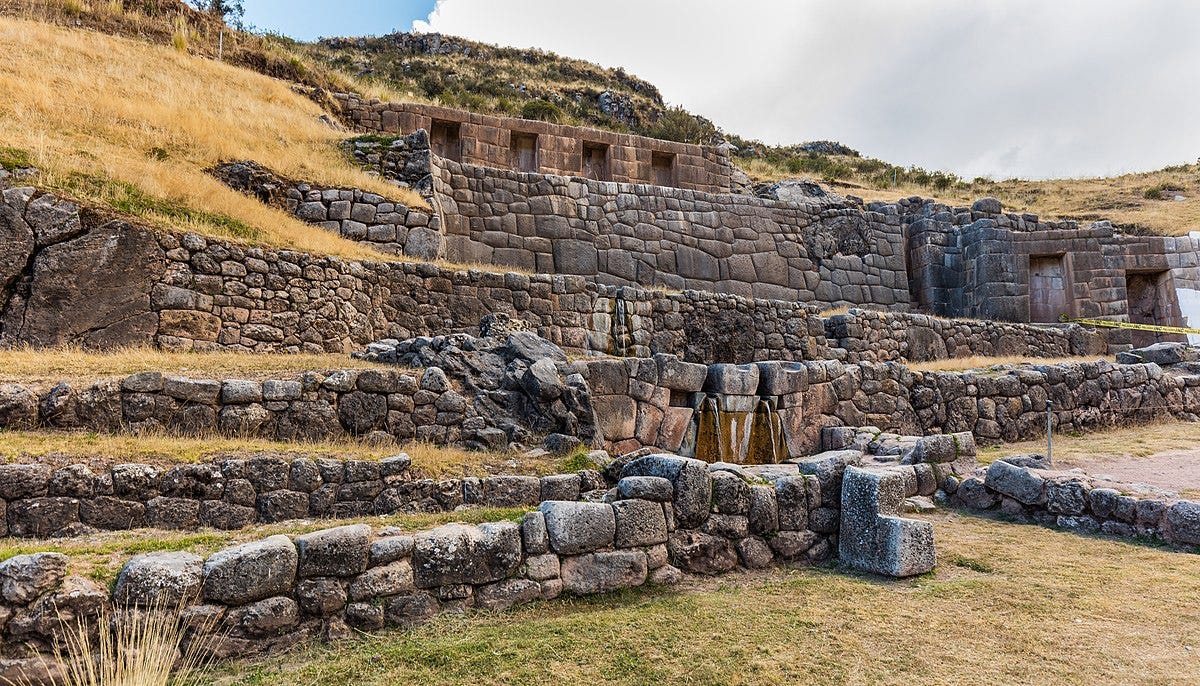
Tampu are roadside building complexes that were multifunctional as they were multitudinous. Craft production, local administration, ceremonial activities, resource exploitation and troop mustering are all conceivable uses of tampu sites (Hyslop, 1984, p. 280), however a general purpose common to almost all tampu would be their use as points of rest and resupply for traveling state personnel (Hyslop, p. 275). This is indicated by regular placement roughly a day’s walk apart along well-travelled roads (Hyslop p. 275), however placement is also influenced by nearby agriculture, water sources, and availability of mi’ta labor - locally taxed seasonal labor obligations to work on state project - to maintain and replenish tampu stores (Hyslop, p. 284). Although varying from fine-cut Inca masonry to rough-shod pirka, tampu features typically include lodging structures, storage silos and pits, housing areas and administrative buildings (Hyslop, p. 293).
Although evidence is scant, Hyslop hypothesizes that Chaskiwi messenger systems may have operated out of tampu sites, which provided quick communication up and down the decimal hierarchy of Inca administration (316). Additionally, some tampu may have been used as control points to impose tolls on and regulate private traffic as well as direct state business (Hyslop, p. 316). Control points were also likely to be located at bridges, which were a particular marvel of Inca engineering. Andean cultures innovated suspension bridges, floating pontoon bridges, and oroya bridges, which to describe in brief resemble a rudimentary rope-and-basket gondola (Hyslop, p. 326).
Inca engineers utilized these to full effect: a notable example is the 45 meter-length suspension bridge which spanned the Apurimac River. The superior construction, immense magnitude and imposing grandeur of Inca roads, bridges and tampus led early European explorers to remark that it was better built, better maintained and better supplied than any road network in Europe (Hyslop, p. 343). This road system was integral to supplying the gargantuan and complex trade good and wealth finance economy that powered the religious and cultural hierarchy which united the four distinct regions of Tawantinsuyu into one, cohesive cultural unit.
Inca Infrastructure in the Political Economy
Wealth and Staple Finance
The political economy of Tawantinsuyu can be divided into two interlocking exchange networks: wealth finance and staple finance (D’Altroy and Earle, 1985; D’Altroy, 1992; Jenkins, 2001). Staple finance was primarily used to fund military expansion and administrative personnel and labor projects; it consisted of agricultural goods that were easy to produce yet difficult to store and transport (D’Altroy and Earle, p. 188), and so were predominantly distributed in production and consumption through the state network of tampu as decentralized reserves which could be drawn upon in times of need or war. Wealth finance consisted of manufactured craft goods and rare items like bird feathers or spondylus shells; thus it was harder to collect and easier to store or transport. (D’Alroy and Earle, p. 194) and good predominantly flowed from regional production centers towards the centralized political and religious authorities in Cuzco and Quito. Wealth finance also flowed outwards from state capitol to countryside and was used to purchase the loyalty of, and maintain relations with leaders from subdued polities (D’Alroy and Earle, 185).
Exchange within these networks was both dispersed and centralized. Staple goods were procured through labor taxed from subject populations and concentrated at regional central storage facilities (D’Altroy 1992, p. 150). Each province was largely self-sufficient in terms of staple goods because of the high transport costs associated with moving food (D’Altroy and Earle, 1985, p. 189), thus, staple goods flowed along horizontal relations to storage in a local center. Wealth finance, in contrast, flowed upwards along hierarchical relations towards central collection in Cuzco (D’Altroy and Earle, p. 192; Covey, 1974, p. 200; D’Altroy, p. 150). The concentration of stored wealth finance in Cusco was crucial to preventing political power, symbolized in ownership of craft goods, from “centrifuging” away from Cuzco towards the provinces (Covey, p. 180-181). Indeed, wealth finance “stabilized the politically unstable system of decentralized staple finance” (Jenkins, 2001, p. 107) by assuring continued allegiance of provincial authorities to central distributors in Cuzco.
Jenkins (2001) uses the tools of network analysis to analyze the roles of storage and administration sites within this two-tiered exchange economy. He uses three measures – degree centrality, closeness centrality, and betweenness centrality (potential for control of exchange or communication, i.e. bottlenecks) – to determine the relative advantages of 54 sites along the Inca road network. Jenkins finds that degree centrality is highest at Inca administrative or storage centers, for example Cajamarca or Hatun Xuaxua, which were junctions for the collection disbursement of goods (113). Jenkin also finds degree centrality is very low at sites like Cusco and Quito (113). Cusco and Quito, however, have higher closeness centrality owing to the fact they are political and ideological centers of the Empire and require quick communication – and therefore shorter travel distances – to all other sites (Jenkins, p. 116). This facilitates the effective political authority of Cusco, yet Cusco’s betweenness centrality, which indicates control over exchange between other sites, is second to that of Vilcas Huaman (Jenkins, p. 113). I speculate this is due to Vilcas Huaman’s location as an intersection between roads that traverse the sierra highlands and roads that traverse the coast, providing a link between two ecologically – and thus economically – different regions.
Jenkins concludes that Incas built administrative sites with large storage capacities at areas of high centrality to manage staple production and organize labor taxes (130). Storage centers without significant administrative areas were built at areas of low centrality to manage the staple production of self-sufficient provincial populations, while administrative sites without large storage areas were constructed at end-points of the network to facilitate the collection and movement of non-craft wealth finance (Jenkins, 130). The complementarity between the political economy, state infrastructure and approach to imperial management is a remarkable testament to the strategic foresight of Inca state planners - central to this strategy was the construction of large storage facilities for the collection and management of goods.
The Grain Must Flow
The role of state storage centers in the Inca Empire to establish economic and political stability cannot be understated: D’Altroy and Earle (1985) point out, “[the] development of central warehouses in the agrarian state is a key element in the centralization of power and direction within society” (192). De-centralized storage was necessary for bare survival - the heartland of the empire was between 10,000 and 13,000 feet and subject to frost, hail, and drought plagued a short growing season. The lack of navigable rivers, wheeled vehicles, and large draft animals meant transporting large quantities of food was impossible as it would be mostly consumed by the travellers en-route. The end result was a massive and sprawling network of Qullqas, or storage units, through the empire.
Control of storage provided political control for Inca rulers, but storage systems were also an adaptive means of supporting traveling state personnel (Hyslop, 1974, p. 248) given the constraints of transporting foodstuffs long distances (D’Altroy, 1992, p. 158). D’Altroy and Earle explain how storehouses average fluctuations in the supply of staple goods to better meet demand (p. 190) through both weather and political seasons - stores were necessary to fund the constant demands of resident populations, but more importantly satisfy fluctuating demands placed on local resources by transient populations such as laborers and armies (p. 191). The supply and reinforcement of state institutions in a far-flung empire was contingent upon the development of extensive storage systems (D’Altroy and Hastorf, 1984, p. 335) of Qullqas.
When Pedro Sanchez de la Hoz, the first Spanish chronicler, visited the capital of Cuzco he remaked «[there are] storehouses full of blankets, wool, weapons, metals and clothes and of everything that is grown and made in this realm ... and there is a house in which are kept more than 100,000 dried birds, for from their feathers articles of clothing are made. ... There are shields, beams for supporting house roofs, knives, and other tools; sandals and armor for the people of war in such quantity that it is not possible to comprehend.»
The need to store such large quantities of reserve goods was in part driven by the lack of market economy in the Inca Empire - it was primarily redistributive, with goods collected and taxed by central authorities and then allocated to state priorities or local governance needs. The state exacted its taxes directly in the form of labor known as the mi’ta system - goods farmed or produced while serving mi’ta labor were directly stored in state warehouses and at the command of state officials. With high altitudes, freezing climates and dry winds, food like potatoes or dried meat could have storage life of up to 4 years, although most popular among the Inca army was dried fish ground into a powder which could last up to 10 years in dry storage.
It’s estimated at any given time in Inca history, there was up to three to seven years worth of food in state warehouses sufficient to feed the entire population, at its peak 12 million people. The powerhouse of this agricultural juggernaut were grains like quinoa and tubers like the potato, which forever changed the trajectory of European history by providing three times more calories per acre than grain while growing in a wider variety of climates and soils.
An example of such a facility can be seen at Hatun Xuaxa, located on the north bank of the Rio Mantaro. D’Altroy and Hastorf (1984), in their archeological survey of the Upper Mantaro Valley, report that 2,000 storehouses organized into 52 architectural complexes lined the hillsides above Hatun Xuaxa (1984, p. 345). Storage complexes were located on hillsides in order to facilitate proper drainage and ventilation, particularly important for freeze-drying and storing maize for long periods of time (D’Altroy and Earle, 1985, p. 191). The storehouses themselves, qollqa¸ were one-room structures either rectangular or circular in shape and constructed using pirka masonry, additionally some remains indicate the interiors were coated with plaster (D’Altroy and Hastorf, p. 343). Morris (cited in D’Altroy and Hastorf) hypothesized that circular and rectangular storehouses were used for storing different types of goods, however surface samples collected at Hatun Xuaxa indicated that the function of storehouses was not specialized by shape (343).
Hatun Xuaxa had a total storage capacity of 123,716m3 (D’Altroy and Hastorf, p. 336), however due to storing practices for agricultural goods it is likely only 10-75% of that capacity was utilized (D’Altroy,1992, p. 164). Even so, if the capacity of storehouses can be taken to indicate the size of agricultural fields under production, then it is unlikely that such a quantity of produce would be required to support the limited permanent population in and around Hatun Xuaxa (D’Altroy, p. 163). As such it is probable that storehouses at Hatun Xuaxa were intended to fund corvee labor, transient state personnel and Incan armies travelling the Imperial highway that intersected the city (D’Altroy, p. 167). Hatun Xuaxa was situated at the juncture of roads leading north to Ecuador, south to Cusco, West to the mountains and East to the coast, making it probable it was a site of high traffic of all varieties (Hyslop, 1984, p. 258), emphasizing storehouses’ role in supporting mobile populations with an immobile resource base (D’Altroy 147).
Terracing and Irrigation
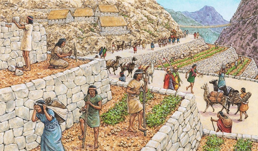
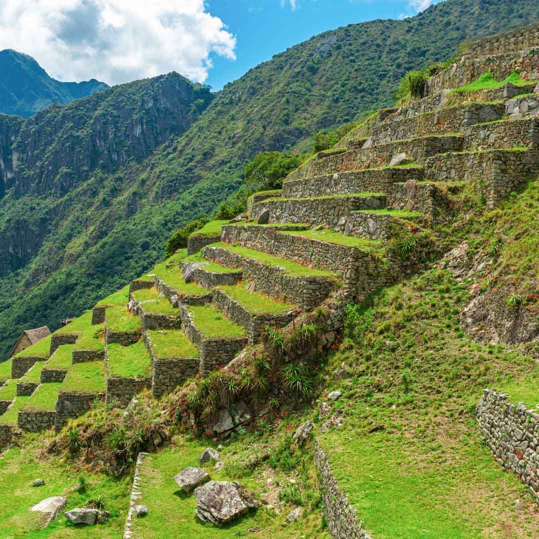
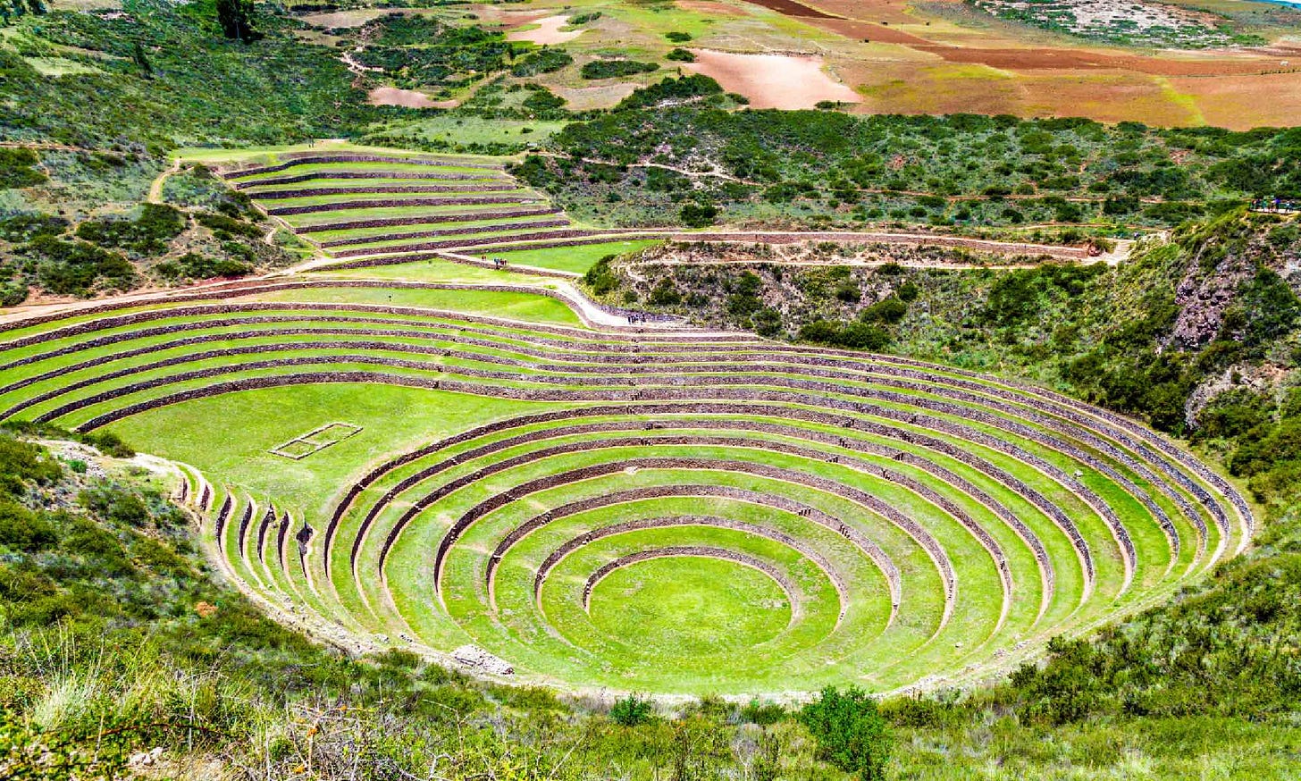
Covey (1974) outlines how the resource base of Incan provinces was drastically improved by importing labor for the purpose of constructing infrastructure projects such as irrigation canals and terraces (172). During their initial expansion, The Incas terraced dozens of hectares of land and canalized 23km of river in the Sacred Valley region (Covey, p. 125, 172). Covey argues these projects in Sacred Valley improved marginally productive lands by consolidating previously isolated villages and by taking advantage of un-used valley floors. This provided the logistical base necessary to mobilize armies, labor, and expand into new territory.
In a contemporary survey of Peruvian terrace farming, Guillet (1987) outlines how terracing and irrigation improve agricultural surplus: building up thicker layers of topsoil on sloped hillsides; increasing water retention; accessing water reserves from mountaintop glaciers; and diverting excess flows to lower terraces, maximizing water utility. Terrace construction uses techniques that date back to the Middle Horizon period, but large scale terracing is labor intensive and requires massive labor mobilization (Guillet, p. 411). As such Guillet describes terraces as “perfected” with the introduction of Inca rule (p. 409). Lower terraces along the Colca Valley built during Inca rule continue to be in use to the present day, despite requiring constant maintenance (Guillet, p. 410). While the labor to construct massive terrace and irrigation projects was organized through the Inca state (Covey, p. 172), the management of water resources within terraces was always administered by Ayllu authorities, even within the state capital of Cuzco (Guillet, p. 410).
The Ayllu were the fundamental building block of the Incan polity and organized around the family unit and defined by kinship relations, and had the exclusive jurisdiction over managing water and irrigation rights in all farming activities. In a region several family ayllu’s were collectively known as a moiety, where political power was organized by familial closeness to an initial founding ancestor. The closest ayllu to a founding ancestor had political authority over the moiety, indeed in the highest-ranking ayllu of the capital, the closest ayllu had control over the empire. The close familial relationships and focus on co-operation, balance, regenerative agriculture, and cyclic nature of life, death, and growing seasons tied together the farmers almanac of annual rhythms to the cultural practices that made up religious and cultural identity.
Administration and Inca State Infrastructure
As the boundaries of their empire expanded the Incas enforced standardized rules of governance to a growing diversity of ethnic populations, cultural traditions and languages, and re-structured local traditions around the ayllu-moiety political economy (Covey, 1974, p. 184). Because of regional variations, as well as limited state resources, there was variability in how these rules were applied (D’Altroy, 1992, p.134), leading to relatively fragmented landscape of regional areas connected by state highway network. To project state power throughout the empire, the Incas undertook the construction of the infrastructure of state - planned cities that dominated the landscape as centers of religious and military power.
Civil Engineering of Incan Politics
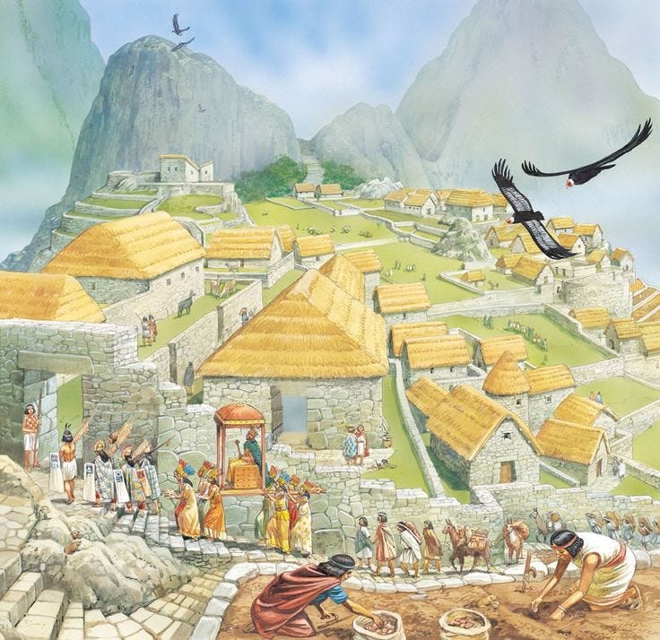
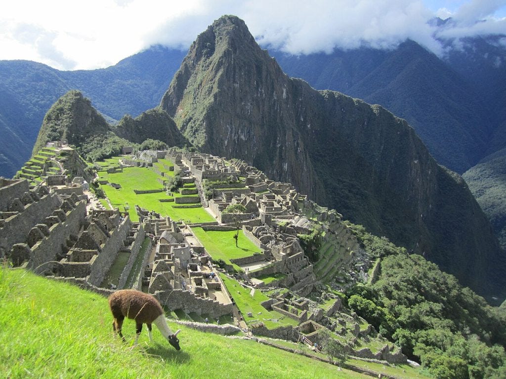
Although there are many examples of magnificent Incan state cities, notably the royal palace at Macchu Pichu, I’ll use two examples here: Huanuco Vieja and Hatun Xuaxa.
Huanuco Vieja was located along the central highway between Quito and Cuzco and was entirely planned and constructed by state personnel, as opposed to arising naturally out of local needs (Morris and Thompson, 1970). This is evidenced by the stark contrast between the architecture of structures within the city and surrounding area as well as stratigraphy samples and test pits that indicate no prior settlement on the location (Morris and Thompson, p. 344-345). The city was built as an important link in the overall network of communication, transport and administration that connected Cuzco to outlying provinces, thus most inhabitants were transient apart from a small permanent administrative population (Morris and Thompson, p. 359).
Unortunately the layout of Hatun Xuaxa is difficult to reconstruct as it was thoroughly destroyed by retreating Inca forces to prevent its’ capture by Spaniards (D’Altroy, p. 106). Inca city sites carried out many functions, but most importantly from an administrative perspective they housed the great palaces from which the Cuzco elite ruled the provinces.
Palaces
Craig Morris (2004) describes palaces as embodying the central authority of Inca rulers even when those rulers cannot be physically present. Their function as residences for elites is secondary to the bureaucratic operations carried out within; they are “vehicles of state creation” and a “symbol and substance of the state itself” (Morris, p. 330). By this Morris means that palaces were the space in which social relations between Inca rulers and their subordinates were formed. Thus they were the means by which local polities became integrated within the Inca state. Yet they were also monumental and publicly visible signs of Inca state authority, their imposing grandeur and magnificence a testament to the power of Cuzco. Bureaucrats operated out of the palace, managing state affairs and resources; thereby palaces embodied the state in both form and function (Morris).
Summarizing the early Spanish chronicler Martin Murua (cited in Morris, 2004), palaces were organized in a series of plazas and gateways that created a gradation between ethnic locals and Inca rulers. A palace is typically centered on a city’s main plaza used by the local population; the palace is accessed by a gateway that leads into another much smaller plaza housing intermediaries between Inca rulers and local authorities. This secondary plaza leads to another gateway which accesses a second interior space housing the “Inca by privelage”, royal retinue and Inca lords (Morris, p. 309). The decreasing size of plaza space is associated with increasing exclusivity and prestige. Palaces thus created a conceptual and spatial differentiation between the local population, intermediaries, and Inca rulers (Morris).
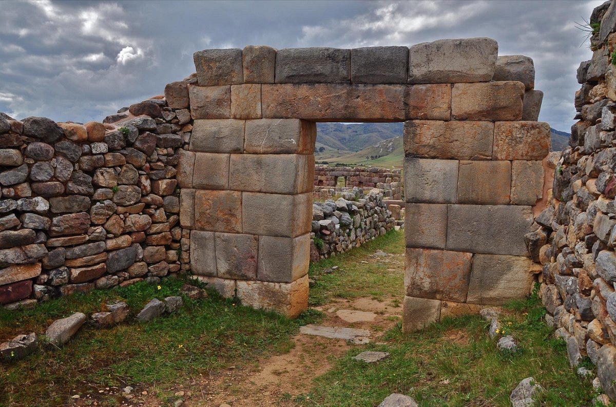
An example of such a palace can be found in the eastern section of Huanuco Pampa (Morris, 2004). The immense central plaza of Huanuco Pampa is thought to be intended for the local populations’ use while the eastern section of the city spatially and materially resembles a palatial compound resembling Murua’s description (Morris, 318). An initial gateway of rough stone separates the palace from the plaza, after which are two more gateways of fine-cut Inca masonry (Morris, p. 313). A smaller plaza in which Inca ceramics were found separates the second and third gateways (Morris, p. 313). The central placement, immense size, and superior-quality construction of this palace would seem to correspond to the intensive-territorial style of administration (Covey, 1974). This is likely considering Huanuco Pampa is within the corridor from Cuzco to Quito, an area Covey (1974) refers to as the most integrated and tightly controlled region of the empire – the “Inca heartland”.
An example of a palace showcasing the decentralized governorship structure within the Inca empire is found in La Centinela, the capital of the Chinca Kingdom (Morris, 2004, p. 320). The Chinca kingdom remained a semi-autonomous polity answerable to Inca rule, as such the construction and grandeur of the palace in La Centinela reflects a more equal status between Inca authorities and the surrounding city (Morris, p. 321). The palace is located off-center of the main plaza and is much smaller relative to its’ surroundings than the palace at Huanuco Pampa (Morris, p. 322). The interior plaza between the first and second gateway is also proportionally smaller than that at Huanuco Pampa, which Morris argues is due to the Chinca kingdom maintaining its own hierarchical political structure (322). According to Murua (cited in Morris), the secondary plaza was used to maintain interactions between Inca elites and local populations (318). Because such interactions were carried out between Inca rulers and the existing political structure in La Centinela, there is less space required for intermediaries between Incas and the local population (Morris, p. 322).
Shadow of Inca’s Heights
The supply chain infrastructure and civil engineering projections of Inca state power were among the most robust and well-engineered in the world at the time, despite the lack of wheeled transportation, market economy, or written language. Incan empire instead engineered its foundations by an intricate and intentional system of social relationships, obligations, and flexible de-centralized authority structures that produced locally stored and distributed staple and wealth goods.
As Covey (1974) outlines, Inca preferred an initially indirect method of securing control – gifts, friendships, and alliances (p. 185) when expanding their borders. Having established a presence, Inca would leave behind state administrators to organize labor taxes and begin the construction of infrastructural projects. These projects were undertaken piecemeal as to avoid direct confrontation with local rulers, yet gradually the subsistence base of an area would become concentrated under Inca control. As D’Altroy and Earle (1985) explain, the separation of centers of storage from centers of population enhanced Inca control, yet it also undermined the authority of local rulers whose legitimacy was based on their ability to provide for their subjects (Covey, p. 187). At times this strategy precipitated rebellion followed by brutal Inca suppression, at others acquiescence as local rulers became infatuated with Cuzco’s supply of wealth finance in the form of artisan-crafted luxury goods (Covey, 1974; D’Altroy and Earle, 1985).
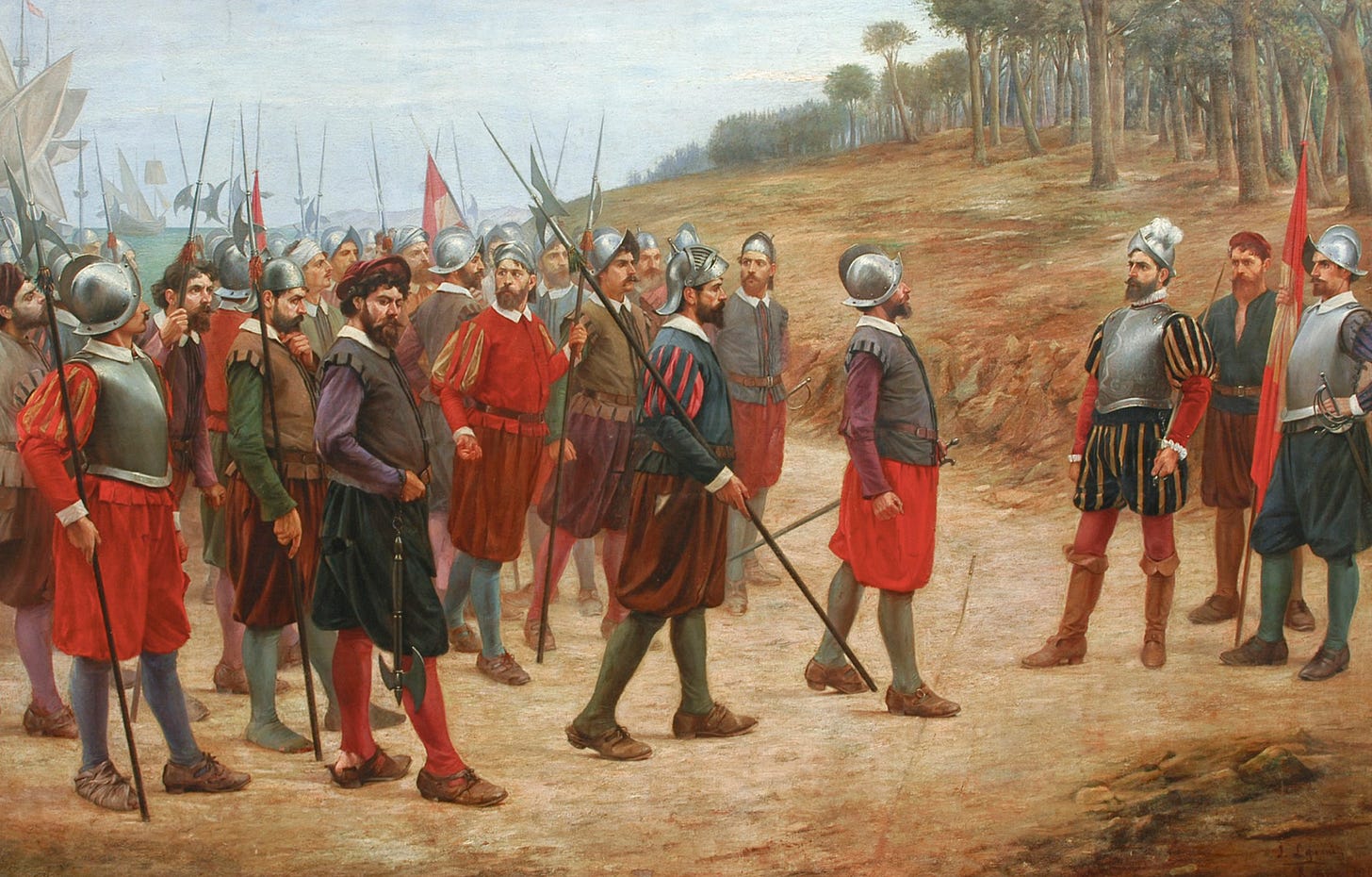
Although the Spanish conquistadors were undoubtedly the proximate cause of the fall of the Inca Empire, by the time Pizarro arrived it was already facing severe internal friction due to the difficulty in managing diverse regional cultures under a unified imperial control. They were aided in their conquest by the sudden death of the then-ruler Huayna Cpac and his eldest son and heir, probably from smallpox, throwing succession into uncertainty and triggering a war between the two closest relatives, one in Quito and one in Cuzco, known as the Inca Civil War. Were it not for the civil war and rampant smallpox which decimated the Inca population, despite their advantage in steel, horses, and primitive fire-arms, its unclear whether the initial conquistador expedition could’ve conquered the well-supplied and well-populated Incan army.
But they did, and by the end of the civil war, pandemic and Spanish conquest the population declined by an estimated 95%, with 75% of that reduction coming between just 1520 to 1570 - some 8-9 million deaths of the 12 million population.
There lies Peru with its riches;
Here, Panama and its poverty.
Choose, each man, what best becomes a brave Castilian.
— Francisco Pizarro
Reference List
Covey, R. A. (1974). How the Incas built their heartland: state formation and the innovation of imperial strategies in the Sacred Velly, Peru. Ann Arbor: University of Michigan Press.
D'Altroy, T., & Earle, T. (1985). Staple Finance, Wealth Finance, and Storage in the Inka Political Economy. Current Anthropology, 26(2), 187-206.
D'Altroy, T. N. (1992). Provincial power in the Inka empire. Washington: Smithsonian Institute Press.
D'Altroy, T. N., & Hastorf, C. A. (1984). The Distribution and Contents of Inca State Storehouses in the Xauxa Region of Peru. American Antiquity, 49(2), 334-349.
Guillet, D. (1987). Terracing and Irrigation in the Peruvian Highlands. Current Anthropology, 28(4), 409-430.
Hyslop, J. (1984). The Inka road system. Orlando: Academic Press.
Jenkins, D. (2001). A Network Analysis of Inka Roads, Administrative Centers, and Storage Facilities. Ethnohistory, 48(4), 655-687.
Morris, C., & Thompson, D. E. (1970). Huanuco Viejo: An Inca Administrative Center. American Antiquity, 35(3), 344-362.
(Covey, 1974; T. D'Altroy & Earle, 1985; T. N. D'Altroy, 1992; T. N. D'Altroy & Hastorf, 1984; Guillet, 1987; Hyslop, 1984; Jenkins, 2001; Morris & Thompson, 1970)


